As a lot of Scout Groups continue to run sessions online, I decided to develop a PowerPoint Presentation which can be used to introduce Scouts to the idea of Grid References. It tries to covers all the basics, starting off simple and getting a little more complex over time.
The basic topics include:
- Why we use grid references
- How to locate a grid reference
- The numbering system we use on the grid
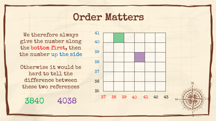
- The order of numbers in a reference
- 4 figure and 6 figure references
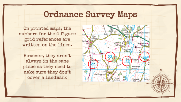
- Ordnance Survey (OS) maps
Each section includes an activity for the Scouts to complete, usually based around either working out a reference or locating what is at a given location.


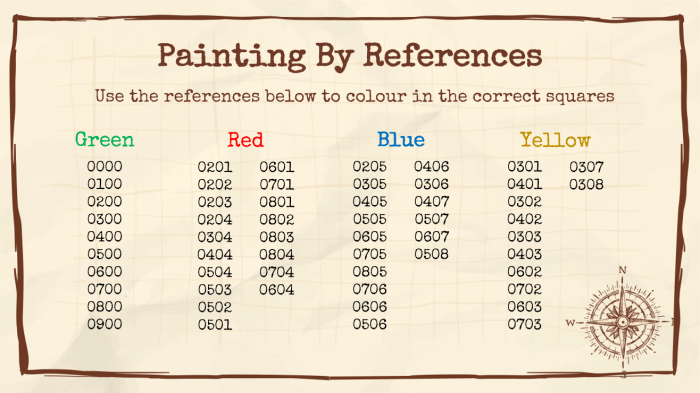
At the end there are two additional activities which are adapted versions of “Painting by Numbers References” and a “dot-to-dot”.

All of the activities have hopefully been designed in a way that all Scouts can take part at home with just a piece of paper and some coloured pens/pencils. For the last two activities there is a printable grid available, but it is also possible for the young people to draw their own.
Downloads
| PowerPoint | Printable Grids |
IMPORTANT: To make sure that the PowerPoint Presentation displays correctly, please install the following free font:
| Special Elite |
Online OS Maps
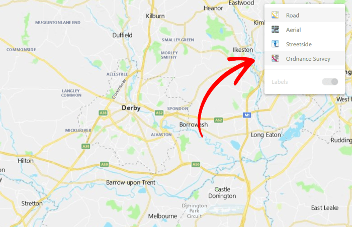
Whilst creating this PowerPoint, I learnt that Bing Maps offers the ability to display Ordnance Survey maps online for free. I used this feature to get the screenshots used in the presentation, but thought I’d share in case you want to explore your own area of set some follow up questions for your Scouts.
To access is, load up Bing Maps, select the button in the upper right corner and swap to the Ordnance Survey mode.